Muggy conditions to linger after stormy, steamy Melbourne night
Save articles for later
Add articles to your saved list and come back to them any time.
Dramatic thunder and lightning, heavy fog, humidity and rain: Victoria has endured a turbulent start to Australia’s El Nino summer, and the state is set to toss and turn through another restless, sticky night.
Thunderstorms are forecast to hit Melbourne on Wednesday afternoon but the predicted cool change will not flow through the city until the early hours of Thursday.
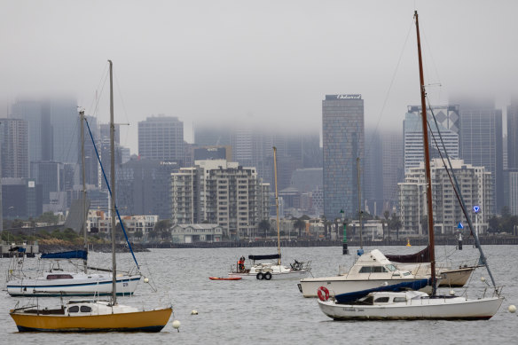
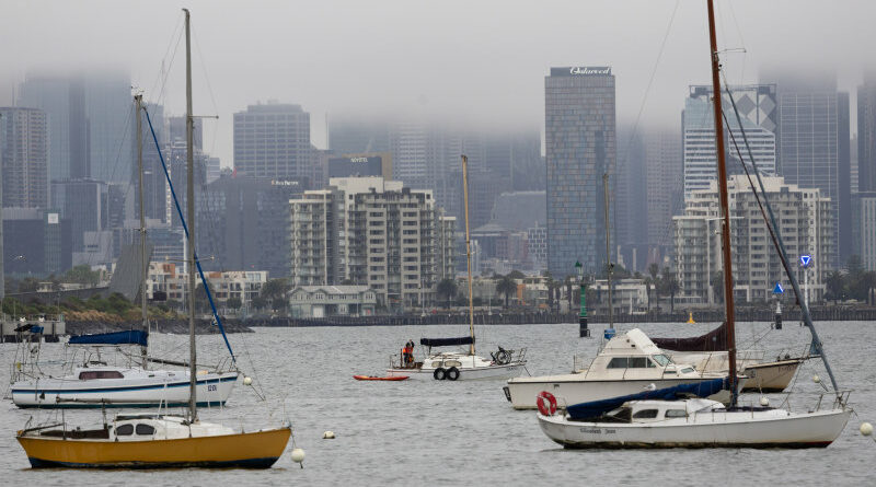
Melbourne’s CBD has been shrouded in fog this week.Credit: Jason South
Some areas of Victoria are also facing extreme fire danger ahead of the cool change.
Bureau of Meteorology spokeswoman Stephanie Miles said the temperature in central Melbourne was expected to peak at 33 degrees on Wednesday afternoon and residents could expect the combination of humidity, wind and rain to feel “pretty horrible” throughout the day.
“There’s quite a lot of shower activity around and we’re expecting storms throughout the day,” she said. “A westerly change is coming around 8 or 9pm, which might bring a bit of relief.
“But more of a true change is only coming through overnight, when temperatures will drop to 18 degrees.”
Miles said a tropical air mass had formed over Victoria, meaning thunderstorms could not help to ease the humid conditions.
“The fact it’s been persisting for a couple of days is probably making people feel worse about the mugginess,” she said.
Across greater Melbourne, temperatures did not drop below 19 degrees in Wednesday’s early hours, while winds of up to 100km/h were recorded in Port Philip Bay near St Kilda.
“Storms last night moved from the northern suburbs over the city then into the Philip Island area [south-east of Melbourne],” Ms Miles said.
“Every time you get a storm you should get lightning too. Perhaps it seemed a little more impressive [on Tuesday] night because the thunderstorm cell was large – it extended from the city down to Moorabbin [20 kilometres south-east] at one point,” Miles said.
A total fire ban is in place for the Mallee, Wimmera and Northern Country districts in the west and north of Victoria, where hot weather and strong winds are forecast for Wednesday.
In Mildura, temperatures are set to reach 35 degrees with winds of up to 40km/h.
A thunderstorm asthma warning has also been issued for Melbourne, Geelong and surrounding areas, as well as western and southern Gippsland.
The Victorian health department said the combination of high grass pollen levels and thunderstorms with strong winds posed a risk to those who sufferered from asthma. Moderate thunderstorm asthma warnings are in place for the rest of the state.
Melburnians hoping to cool off in Wednesday’s heat with a splash in the sea may also be disappointed: water quality at the majority of beaches around Port Phillip Bay has been marked “poor” by the Environment Protection Authority due to stormwater pollution.
In northern Queensland, residents are bracing for Tropical Cyclone Jasper to slam the coastline near Port Douglas, north of Cairns, by Wednesday lunchtime.
The category 2 system is expected to bring intense rain alongside winds that could damage trees, roofs and properties. The mayor of Cairns has urged locals to prepare for up to five days without power amid panic buying in supermarkets.
Victoria’s State Emergency Service received 20 calls for assistance between midnight and 10am on Wednesday as strong winds and lightning arrived.
Thirteen of the 20 calls were in response to fallen trees, many in the Colac area south-west of Melbourne, while three were for building damage in Melbourne’s south-eastern suburbs.
The Morning Edition newsletter is our guide to the day’s most important and interesting stories, analysis and insights. Sign up here.
Most Viewed in National
From our partners
Source: Read Full Article